During the widespread flooding that took place in the area in early July 2023, the Gulf Stream — which runs off the Ottauquechee River — transformed from a mild flow to a raging torrent. Kelly Stettner, district manager for the Ottauquechee Natural Resources Conservation District described the river as a “surging force along Route 4 just north of Woodstock.”
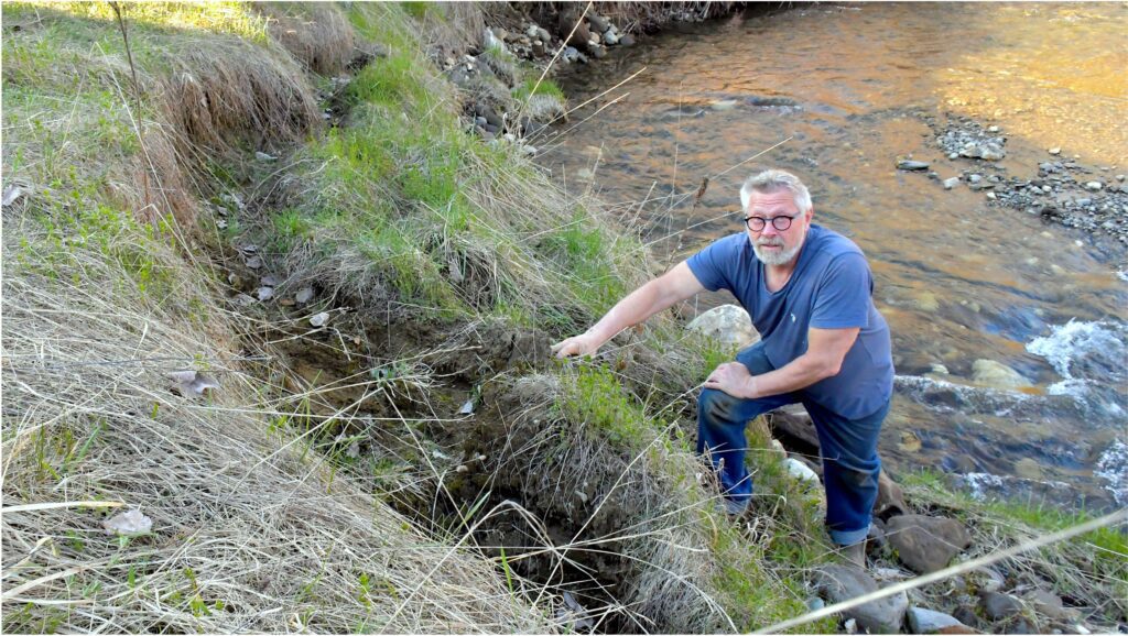
Erceg stands in the thick of the eroded embankment a few feet from his home. During the mass floods in early July 2023, the Gulf Stream, which runs off the Ottauquechee River, transformed from a mild flow to a raging torrent, resulting in the erosion Erceg experiences today. Rick Russell Photo
“The flooding brook ran into a snag of large, downed trees — the powerful water needed somewhere to go. It turned sharply right, tearing at the bank and eroding tons of soil in its path, carving closer and closer to the foundation of a private home,” Stettner added.
That home belongs to Todd M. Erceg, a longtime Vermonter who bought his home a mile from Woodstock Village a few years before the 2023 flooding. Erceg told the Standard, “When the hard and heavy rains came in the spring [of 2023], the erosion started.”
Erceg told the Standard that the erosion began disrupting foundational elements of the property, moving closer to the house. That was when he decided the state had to be involved in helping to fix this problem.
“This is a problem that slowly unravels over time,” Erceg said. “You don’t see it, but slowly the land begins to crumble. It needed to be addressed, and so I applied for a state permit.”
Through this process, Erceg became acquainted with Stettner, as the two now work together to assess and fix the eroding land.
Stettner explained the timeline and logistics of this project, saying, “After the initial site visit, we drew up a map and made some rudimentary plans, knowing that a project of this magnitude wouldn’t be finished until 2028 or 2029.”
The ultimate goal of this project is to reroute the river flow, so it stops pounding against the embankment on Erceg’s property. This will be done by installing wood barriers to help push the water flow in the right direction, and planting trees to keep loose sediment from corrupting the waterways, Stettner explained. However, this could only happen once a preliminary design is complete and grants are secured.
For more on this, please see our April 30 edition of the Vermont Standard.